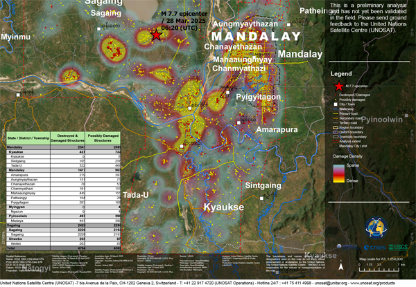
The latest map from the United Nations Satellite Centre (UNOSAT) shows the density of damaged buildings caused by the March 28, 2025 earthquake, focusing on Mandalay and Sagaing Districts.
- Within the map extent of about 2,100 km², UNOSAT, Copernicus EMS and ICube-SERTIT observed a total of 4,764 destroyed and damaged structures & 4,369 potentially damaged structures.
- Within Mandalay City boundary of about 110km², a total of 1,076 structures are observed as destroyed and damaged, & a total of 519 structures are observed as potentially damaged.
Please Note: This is a preliminary analysis based on satellite imagery and has not yet been validated in the field. UNOSAT welcomes ground feedback to refine the assessment.