The latest Article from Center for Development and Environment (CDE), University of Bern, features the use of OSM for Humanitarian and Development Activities. Dubbed as the “Wikipedia of Cartography.””, OSM is a collaborative, open-source mapping project that provides free, editable geographic data to users worldwide.
In Myanmar, where there are many limitations on ground mapping, particularly in hard-to-reach areas during disasters and conflict, OSM plays a crucial role in quickly generating accurate, community-driven maps to support emergency response and planning.
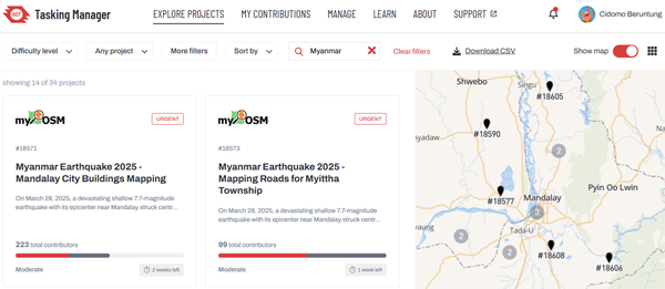
In response to the earthquake, the Humanitarian OpenStreetMap Team (HOT), together with the global open mapping community, is supporting Myanmar's OpenStreetMap community (myOSM) to improve the quality of building footprint and road data in affected towns and communities. Through this newsletter, we’ve been sharing the calls to contribute on the mapping platform.
Read more on the MIMU website.