The Copernicus Emergency Management Service (CEMS) is one of six services provided by Copernicus, the Earth Observation component of the European Union’s space programme. The Rapid Mapping Service was activated approximately 3 hours after the earthquake and concluded yesterday after analysing 57 Areas of Interest (AOIs) and releasing 68 satellite images.
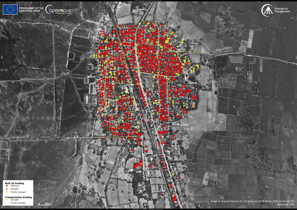
Based on this data, CEMS estimates that 17,843 buildings and 11.7 km of roads have been affected across these AOIs. Additionally, in AOI28 (Sinthay River), flooding due to a dam breach impacted a built-up area of 1.30 hectares, and 1.50 km of roads.
Review the situation report on the CEMS Activation page.
Download the maps for each AOI here.