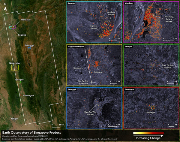
Earth Observatory of Singapore (EOS) recently released a comprehensive Damage Proxy Map (DPM) covering approximately 158,000 square kilometres, including Mandalay and many other cities and small towns in Myanmar near the fault rupture that caused the Mw7.7 earthquakes on 28 Mar 2025. The map was derived from SAR data acquired on 3 Apr 6:09 PM local time from the Copernicus Sentinel-1 satellites operated by the European Space Agency (ESA). The figure below shows an illustrative image of the map, and the map can be downloaded from this webpage (filenames: EOS-RS_20250403_DPM_S1_Myanmar_Earthquakes_v0.9.kmz and .tif)
The KMZ file is very light and portable (25 KB), making it useful for viewing the maps in the Google Earth app on mobile devices used by on-the-ground teams for field operations.
The GeoTIFF file is large (~1 GB) and can be drag-and-dropped into GIS software (e.g. QGIS or ArcGIS) for further analysis in support of decision-making efforts.