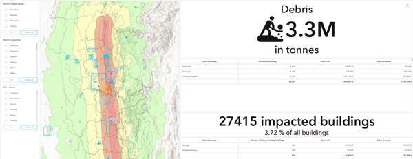
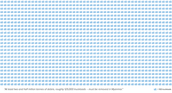
Why debris matters – At least two and a half million tonnes of debris, roughly 125,000 truckloads, must be removed in Myanmar. These figures, coming from UNDP’s remote sensing analysis, underscore the urgent need for large scale debris removal and repairs and reconstruction of critical infrastructure and homes as part of the ongoing recovery efforts.
UNDP’s analysis integrated advanced satellite derived building damage classifications from UNOSAT and Copernicus with Microsoft’s building footprint data, supported by local data such as admin boundaries and population figures. This enables immediate targeting of priority areas for debris removal and recycling, guiding the deployment of national engineers to undertake rapid structural assessments of public service buildings, critical infrastructure, and affected homes—information that directly informs rehabilitation and reconstruction plans.
Read more to see how remote sensing analysis shows massive, immediate reconstruction is vital in Myanmar.
Explore the detailed analysis through ArcGIS Story Map.