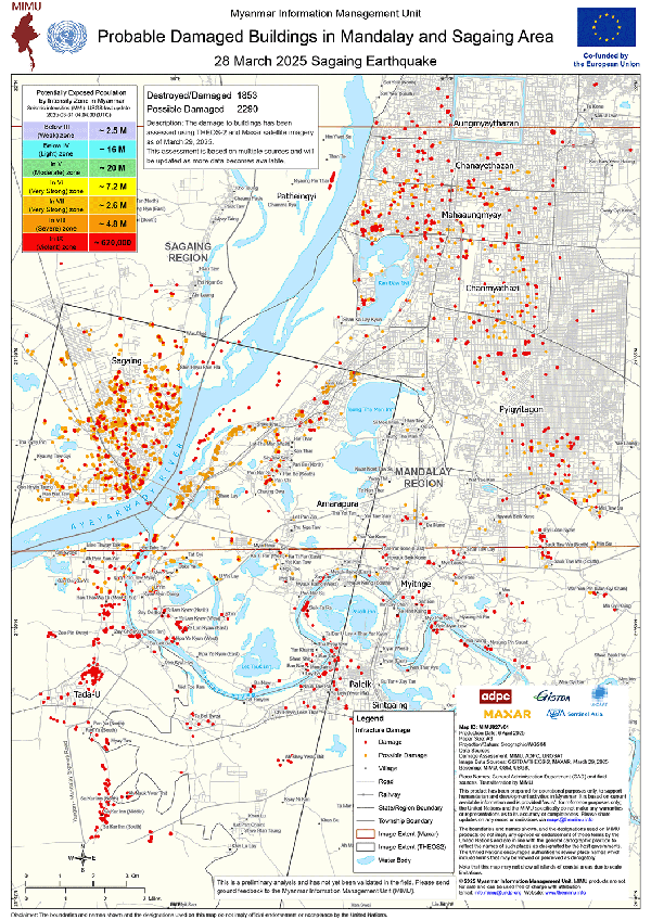
Building on UNOSAT’s preliminary analyses and satellite imagery from THEOS-2 and Maxar, MIMU, with technical support from the Asian Disaster Preparedness Center (ADPC), has developed a map showing probable damaged buildings in Mandalay and Sagaing areas. To improve accuracy, MIMU also used some field validation from MIMU staff on the ground. Within the analysis area, 1,853 buildings were identified as destroyed/damaged and 2,290 as possibly damaged.