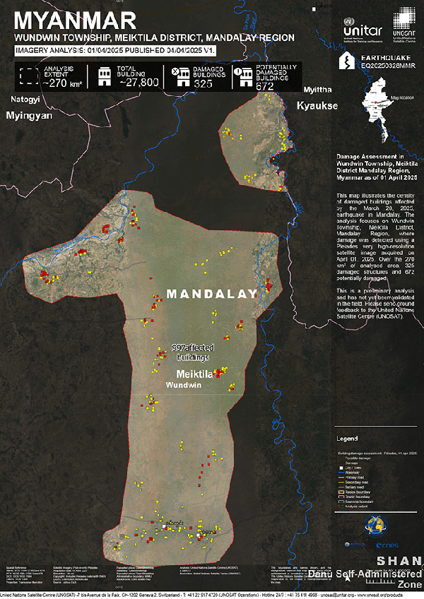
The United Nations Satellite Centre (UNOSAT) has released more results from their assessment of structures potentially damaged by the recent Sagaing Earthquake. Using very high-resolution Pleiades satellite imagery, UNOSAT analysed areas in the Sagaing and Mandalay Regions.:
- Within an analysed area of ~270 km² in Wundwin Township, Mandalay Region, UNOSAT identified 325 damaged structures and 672 potentially damaged structures.
Please Note: This is a preliminary analysis based on satellite imagery and has not yet been validated in the field. UNOSAT welcomes ground feedback to refine the assessment.