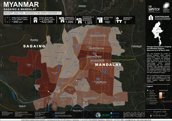
The United Nations Satellite Centre (UNOSAT) has released its initial assessment of structures potentially damaged by the recent Sagaing Earthquake. Using very high-resolution Pleiades satellite imagery, UNOSAT analysed areas in the Sagaing and Mandalay Regions. Here is a brief summary of the results released so far:
- Within 52 Towns/Village Tracts (~340 km²) covering parts of Sagaing and Mandalay, UNOSAT identified 1,095 damaged structures and 1,325 potentially damaged structures.
- Within a specific ~30 km² area analysed in Sagaing Township, UNOSAT identified 233 damaged structures and 557 potentially damaged structures.
- Within an analysed area of ~60 km² covering Mahaaungmyay, Chanmyathazi, and Chanayethazan Townships, UNOSAT identified 509 damaged structures and 284 potentially damaged structures.
Please Note: This is a preliminary analysis based on satellite imagery and has not yet been validated in the field. UNOSAT welcomes ground feedback to refine the assessment.

