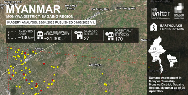
The latest map from the United Nations Satellite Centre (UNOSAT) assess probable damage buildings focusing on a part of Monywa Township, where damage was detected using a WorldView-2 very high-resolution satellite image acquired on April 25, 2025.
UNOSAT identified 27 damaged structures and 170 potentially damaged.
This is a preliminary analysis and has not yet been validated in the field. Ground verification is encouraged, and feedback can be sent to the United Nations Satellite Centre (UNOSAT).