News

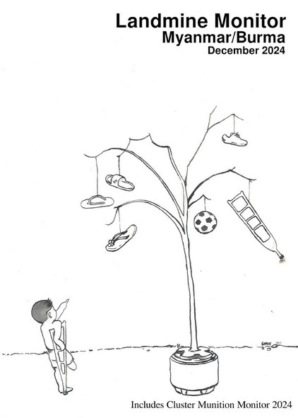
International Campaign to Ban Landmines (ICBL) has produced the annually updated landmine monitor report for Myanmar and is now available in both English and Myanmar languages.

For the first time, Myanmar has more casualties due to landmines than any other country in the world in the previous calendar year, with at least three casualties every day.

Casualties and contamination are reported in all states and regions, except Nay Pyi Taw. Casualties were recorded in 134 townships, and at least 190 (57%) townships are contaminated.

There is a significant increase in contamination and casualties, as well as hazards posed by explosive remnants of war (ERW), with one ERW casualty every three days.

Explore the report for more insights.

Review this recently released report on the Market Analysis Unit’s page.

Did you know that, in the second half of 2024 …

  • We produced 20 satellite-based flood maps in September/October 2024 in response to the Yagi floods?
  • You can follow our social media channels for latest flood updates?
  • Our infographics highlighted the worsening situation for women and girls in Myanmar?
  • 160 people joined our trainings?

If you've engaged with any of these, thank you for being a dedicated user. We hope you found them useful. If not, don’t worry as this MIMU Bulletin offers an in-depth, interactive overview of these activities that you can look forward to using in 2025.

During this period, our support for humanitarian, development, and peace (HDP) initiatives across Myanmar included:

  • Flood Preparedness and Response
  • 16 Days of Activism Campaign
  • MIMU HDP Nexus 5W
  • Trainings

This edition was developed as an interactive infographic for the first time, allowing you to explore the data in depth. If you prefer offline versions, you can also download the PDF infographics:

In addition to the Bulletin above, if you want to learn more about everything MIMU has to offer, please browse the newly updated catalogue of MIMU’s products and services. Now built as an interactive presentation in Canva, we will keep it updated monthly with our latest offerings.

The latest version of MIMU Myanmar Place Codes (version 9.6, February 2025) includes updates on many villages across the country. These updates result from the MIMU village mapping exercise, which was carried out collaboratively with input from our field partner agencies. The most significant changes in this version are as follows:

  • 44 new villages were added in 19 townships across 7 states/regions.
  • 954 villages’ coordinates were newly added in 75 townships across 14 states/regions.
  • 1,198 villages’ coordinates were modified in 21 townships across 5 states/regions.

Detailed information of these and earlier changes is available in PDF and Excel formats. The updated P-codes can be found on the MIMU website’s Place Codes page, along with a Pcode Submissions and Corrections Form through which to share corrections and information on new villages which may not be included in the MIMU Pcode listing.

MIMU PCoder has also been updated, providing users with several options including a selection among 4 dataset versions (9.6 or 9.5 or 9.4 or 9.2) and the flexibility to opt for place names in English or Myanmar (Unicode). You can use it to match PCode and place names as well as to get the coordinates of villages and towns along with their respective place codes and names. Guidelines in both Myanmar and English are now available. Users can also find the guideline video file on the MIMU PCode Webpage.

With this update, we can now map 53,857 villages out of recorded 66,657 villages in MIMU Database.

We are pleased to inform you that in March 2025, MIMU will offer a 5-day intensive online training course in the use of Geographic Information System / GIS application for humanitarian and development activities.

The training is free of charge and the number of seats is limited to twenty five (25) only.  Applicants must proactively submit the application by themselves before the deadline. MIMU has the right to select the applicants according to eligible criteria and availability of seats. If you are selected, you must submit an approval letter from your organization or supervisor and you must be able to attend full-time for 5 days.

Apply directly online at https://ee-eu.kobotoolbox.org/single/cskiicMf
 
Deadline of application: 18th February 2025
Deadline of Confirmation: 21st February 2025
Training Period: March 3rd to March 7th, 2025 (5 days) 9:00 am to 4:30pm daily

Latest map from MIMU chronicles the flood-affected townships in Myanmar from 2008 to 2024 including those affected by Typhoon Yagi last year. In addition, you can easily create your own map based on this data through MIMU Map Maker platform.

We have launched a dedicated page for the Technical Advisory Group on Disability Inclusion. Originally formed as the ICCG Small Group for Disability Inclusion in March 2021, the group was reorganized as the Technical Advisory Group (TAG) on Disability Inclusion in July 2022. Since then, a significant milestone has been the growing participation of Organizations of Persons with Disabilities (OPDs). Nearly half of the current TAG members now represent local OPDs, highlighting their increasing involvement and leadership in disability-inclusive initiatives.

This new page will serve as a hub for organizational documents, technical guidelines, and other useful resources. If you're interested, be sure to bookmark it!

Popular MIMU Power BI Training is now also on SeePuuYar, a Myanmar-language learning platform for data management, GIS, and Remote Sensing. The course is free and self-paced, and those who score 80% or above on the assessment will receive a certificate.

Mapping Myanmar’s industrial and economic zones? The latest additions to the MIMU Geonode platform include point and polygon map layers of these zones and other economic development areas, using publicly available reference data.